Rohingya Today
The area between west bank of Kaladan River and east bank of Naf River, which demarcates Myanmar-Bangladesh border, in North Arakan is known as “Traditional Homeland of Rohingya”. It has been deeply implanted the minds of the Rohingya people despite changes in demography, due to pogrom in 1942 and continued systematic persecution against them particularly from 1962 military rule in Burma. Renowned historians such as, Burma Historical Commission’s compiler Prof. Dr. G.H. Luce and History Prof. Dr. Than Tun haveaffirmed this traditional homeland of Rohingya stating that in North Arakan there was“possibility of Rohingya and their kings in the Mayu valley since 800 years back”.[1]
Moghul fugitive prince Shah Shuja, then Viceroy of Bengal, was killed by Arakanese King Sanda Thudama in 1661 in violation of diplomatic norms while he was taking refuge in Arakan. Emperor Aurangazab was aggrieved over the cold-blooded murder of his brother. In 1666, under the order of Emperor Aurangazab, Moghul commander Nawab Shaista Khan conquered Chittagong (then under Arakanese rule) and the area up to the Kaladan River in Arakan.
In some of his write ups, including the article “Muslim of Burma” published in “The Nation Daily”, Rangoon, dated 12thApril 1959, Ex-Health Minister Sultan Mahmud writes “Saista Khan had conquered up to the Kaladan River.”[2] He also mentioned it in his several parliamentary debates and press conferences.
Sufi A.M Waheed writes “Under the order of Emperor Aurangazab, the Subedor of Bengal, Nawab Shaista Khan deputed his son Buzurg Umad Khan, and in 1666 he conquered Chittagong and annexed the area from Dhoom(the area with Feni River) in Chittagong to Bay of Bengal. The Buddhist (Maghs) population of Chittagong then migrated to Mrohaung and started whispering campaign against the Muslims (Rohingyas). [3]
M.A. Tahir Ba Tha writes, “There is historical observation that Buzurg Umed Khan had conquered whole Arakan but retreated soon”[4]as Bengal had no territorial ambition on Arakan. However, in the absence of clear information, who ruled over the region between the east bank of Naf River and west bank of Kaladan River, it may be inferred that it was under the firm control of the Rohingya people.”[5]
The conquest of Chittagong (by Moghul) had changed in the political landscape between Arakan and Chittagong or Bengal. The Buddhist Rakhines had fled beyond Kaladan River while the Bengal southern border was fixed at the west bank of Naf River or Kaladan River. “With the loss of Chittagong and Ramu the Arakanese Maghs were very terrified and fled from north to south Arakan. At that time, a large number of Muslims from Bengal entered into North Arakan.”[6]
On 7 March 1947, Jamiatul Ulama of North Arakan under the leadership of Barrister Dr. Maulana Sana Ullah met British parliament member Ross William, head of the Rose William Commission, in Maymyo resort city in Shan State, Burma, and submitted a memorandum wherein they demanded that the area between Kaladan and Naf river should be declared as a state pertaining to Rohingya Muslims.[7]
In 1949, the Arakan Communist Party leader Tun Aung Pru, a Rakhine, met Mujahid Party leader Jafar Kawal and they had agreed to fight together until the fall of Anti-Fascist People’s Federation League (AFPFL) government with the understanding that Mujahid would take the western side of Kaladan River, whereas the rest of the Arakan would be under the control of Rakhine communists. It was a clear understanding between the two powerful rebel groups representing their respective peoples – Rakhine Arakanese and Rohingya Arakanese.
One of the seven demands of the Mujahid party was “to form an Autonomous Muslim state named North Arakan with Buthidaung, Rathedaung and Maungdaw taking the region from the West of Kaladan River up to the eastern part of Naf River. This region will remain under the Union of Burma”.[8]
To consider the seven-point demand there were discussions on 3 occasions between the government representatives and Mujahid leaders. In February 1950, Burmese Prime minister U Nu, Minority Minister U Aung Zan Wai (a Rakhine) accompanied by Pakistan Ambassador to Burma Sardar Aurangeb Khan came to Maungdaw in order to hold discussion on the seven demands of the Muslims of North Arakan and summoned the representatives of Arakani Muhajirs (refugees) from Teknaf by the scouts.[9]
In an open letter, dated 10thJune 1951, addressed to the President, Prime Minister and the Government of the Union of Burma, Mr. Saleah Ahmed, President, and Mr. Zahiruddin Ahmed, Secretary, of the Arakan Muslim Conference demanded, “North Arakan should be immediately formed a free Muslim State as other races of Burma.” It indicates that the demand was for equal rights and freedom within the Burmese federation.
At a Mujahid Conference held in late April 1954 at Taungbru in Maungdaw Township, the Mujahids reiterated their demand for Autonomous State, comprising the area between west bank of Kaladan River and east bank of Naf River measuring about 4,000 square miles, while the rest of Arakan with an area of 10,200 square miles will be under Rakhine. It may be mentioned that total area of Arakan was about 18,000 square miles which has now been reduced to 14,200 sq. miles.
It is worth-mentioning that in 2000, Dr. Khin Maung, President of the National United Party of Arakan (NUPA) and Nurul Islam, President of the Arakan Rohingya National Organisation (ARNO) signed an agreement of political alliance declaring that Rakhine and Rohingya are the two major peoples of Arakan and that NUPA and ARNO were legitimate representatives of their respective peoples in Arakan – Rakhine and Rohingya.
Mayu Frontier Administration (MFA)
On 1st May 1961 the government created the Mayu Frontier Administration (MFA) in Northern Arakan, covering Maungdaw township, Buthidaung township and western part of Rathedaung township. The whole area of MFA, also called Mayu District/Mayu Peninsula, is some ninety miles long and about twenty wide at its northern end, when it tapers to a point just short of Akyab/Sittwe Island. MFA was abolished and the area was put under the Ministry of Home Affairs, on 1stFebruary 1964, by “Revolutionary Council” headed by the then Chief of Staff Gen. Ne Win, who seized the power from U Nu on 2nd March 1962.
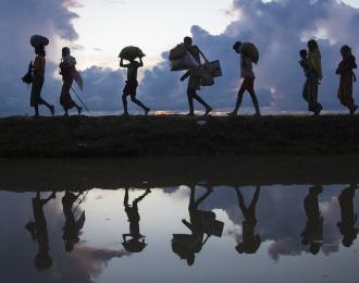
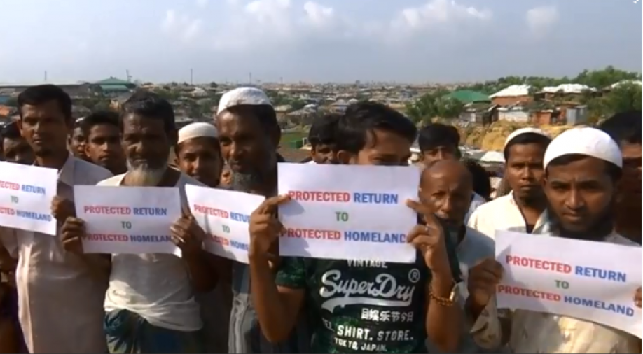
It was military administration, not an autonomous rule. But it earned the support of the Rohingya community mainly for the reason that it did not involve subordination to the Buddhist Rakhine who were hostile to them. However, Mayu Peninsula is not the whole area of the “Traditional Homeland of Rohingya” but a part of it. This vital fact needs to be noted while campaigning for “Protected Return to Protected Homeland” (PR2PH).
[1] Dr. G.E. Luce, “Phases of pre-Pagan Burma Languages and History, Oxford, 1985, PP 76-97.
Dr. Than Tun, “Chin, Mru, and Kami –North Arakan”, “Kalya Magazine” (In Burmese) 1994, August Issue, PP 27-28
[2] AFK Jilani, “The Rohingyas of Arakan: Their quest for Justice”, First edition, 1999, p.115.
In “Muslim in Burma”, an article by Sultan Mahmud (MP), Ex. Health Minister of Burma, published in the Nation Daily, Rangoon, dated 12 April 1959 and his several parliamentary debates.
[3] Ibid. p.116
[4] “Rohingyas and Kamans”, (in Burmese) by M.A. Tahir Ba Tha, p.39.
[5] AFK Jilani, “The Rohingyas of Arakan: Their quest for Justice”, First edition, 1999, p.116
[6] Supra p.39
[7] Manifesto of Rohingya Jamiatul Ulama Arakan p. 4
[8] “The Muslims of North Arakan (Part-1) - What they are struggling for? , by Muzaffar Ahmed Arakani, President Anjuman-E-Muhajirin-E-Arakan, Chittagong., Feb.1955, p.6.
[9] Ibid. pp7-8
Nurul Islam is Chairman of Arakan Rohingya National Organisation.
![Locals evacuate Rohingya refugees from a boat that came ashore on the north coast of Indonesia's Sumatra island in June 2020. The UNHCR says the journey across the Andaman Sea last year was deadlier than ever before [Rahmad/Antara Foto via Reuters]](/sites/default/files/styles/grid_list_330x260_/public/2025-05/2020-06-25T000000Z_355446050_RC2CGH9LTK3V_RTRMADP_3_INDONESIA-ROHINGYA.jpeg?itok=V6ouOxeq)